How Natural Language Processing Can Map Human Stories
Published:
When disaster strikes, people don’t just wait for the news - they post.
- “Roads are blocked.”
- “Water is rising fast.”
- “Please help.”
Each message feels small, but together they form a powerful map of human experience. And the problem appears, there are too many to read.
That’s where Natural Language Processing (NLP) comes in. It can sift through thousands of posts, pull out key places and emotions, and - when combined with geography - turn scattered stories into real-time maps that reveal who needs help, and where.
What is NLP?
At its core, Natural Language Processing (NLP) is about teaching computers to understand and analyze human language. It gives machines the ability to make sense of the words we speak, type, or post online.
You’ve probably used NLP today without even realizing it:
- Asking Siri or Alexa a question
- Using Google Translate to convert a sentence into another language
- Shopping site highlights reviews as “positive” or “negative”.
That’s NLP work, or even the autocomplete on your phone’s keyboard also relies on NLP.
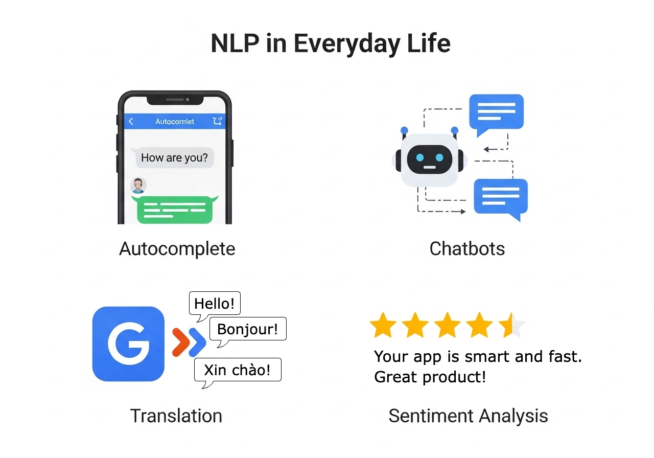 Fig 1. Everyday applications of NLP you’ve probably used today.
Most of the time, these applications are designed to make daily life a bit easier - quicker searches, smoother chats, better recommendations. But the same technology that helps us shop online or talk to a voice assistant can also do something much bigger.
NLP can capture the pulse of humanity. By analyzing the language we share on social media, forums, or messages, NLP can detect emotions, identify needs, and even spot trends in how people respond to global events.
Imagine this: thousands of tweets appear within minutes of a natural disaster. One says, “Roads are blocked”. Another: “Need water ASAP”. Individually, they’re just short cries for help. But NLP can sift through this flood of language, detect urgency, extract key terms like “water” or “blocked”, and identify place names that hint at where the situation is unfolding.
 Fig 2. From text to insights: how NLP breaks down human language.
And when we combine this with geography, something powerful happens: those scattered human stories transform into patterns we can map, making them actionable for disaster response, public health, or social research.
From Tweets to Insights: A Disaster Example
When a disaster unfolds, people don’t wait for official reports - they post. Within minutes, platforms like X can fill with thousands of short, emotional updates:
- “Downtown bridge is gone, water everywhere.”
- “Stuck in my house, need help now!”
- “Relief camp near Riverside school, food available.”
Reading a handful of these posts is easy. But when there are tens of thousands, no human can keep up. That’s where NLP comes in. NLP can:
- Sport keywords like “help”, “flooded”, “shelter”
- Analyze urgency or sentiment, detecting fear, panic, or relief.
- Extract places names (”Riverside school”, “Downtown bridge”) to anchor each post to a real-world location.
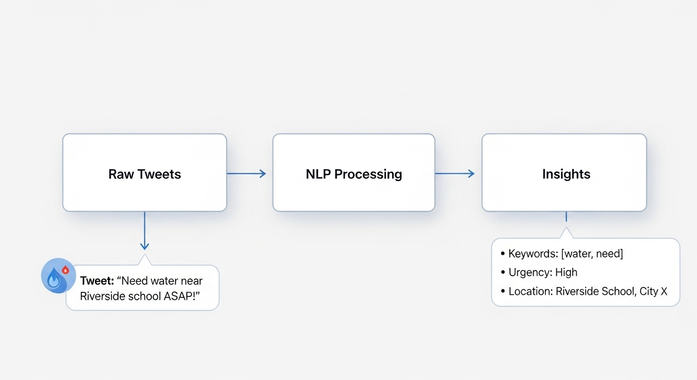 Fig 3. How NLP transforms chaotic posts into structured signals.
For those curious about the “how”, the logic is simpler than it sounds.
for each tweet in stream:
	detect_keywords(["help", "water", "food", "shelter"])
	analyze_sentiment(tweet)
	extract_location(tweet)
	classify_urgency(tweet)
	save structured_result
| Tweet | Keywords | Urgency | Location |
|---|---|---|---|
| Need water near Riverside school, ASAP! | water, need | High | Riverside school |
| Downtown bridge is gone, water everywhere | water | Normal | Downtown bridge |
| Relief camp open at central park, food available | food | Normal | Central park |
Tab 1: From raw tweets to structured insights.
This isn’t magic, and it’s not perfect. Tweets may contain slang, sarcasm, or errors. Some posts might spread rumors. But even with limitations, the overall effect is powerful: what feels like scattered noise becomes signals we can map - helping responders see where problems are emerging in real time.
Adding Geography: Mapping Human Stories
Turning text into structured signals is only half the story. To truly understand human experiences, we need to place them on the map. That’s where geography comes in.
On paper, structured tweets are just rows in a table. But if we geocode the place names (”Riverside school”, “Downtown bridge”), we can convert them into coordinates. Suddenly, human stories become dots on a map - and patterns begin to emerge.
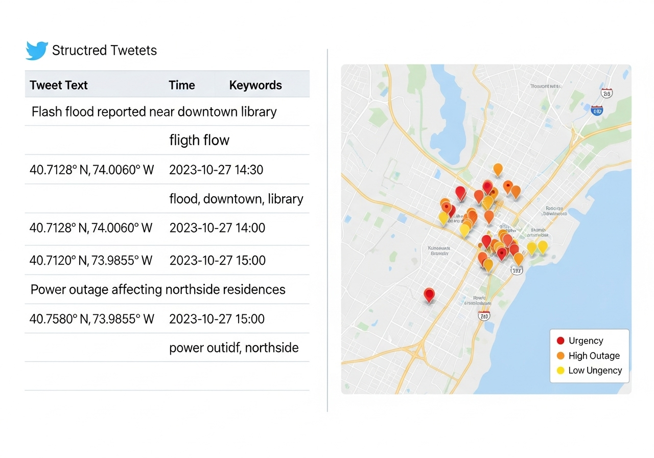 Fig 4. From text to map: how language becomes spatial insight.
Here’s a pseudocode sketch of how this works:
for each structured_tweet in results:
	location_name = structured_tweet["location"]
	coordinates = geocode(location_name) # convert place names to lat/lon
	map.add_point(
		lat = coordinates.lat,
		lon = coordinates.lon,
		color = urgency_color(stuctured_tweet["urgency"]),
		label = structured_tweet["keywords"]
	)
This step transforms scattered messages into something actionable:
- Clusters of red points = areas with urgent needs.
- Blue or green points = locations offering help, food, or shelter.
- Empty spaces = silent zones where information may be missing, but help could still be needed.
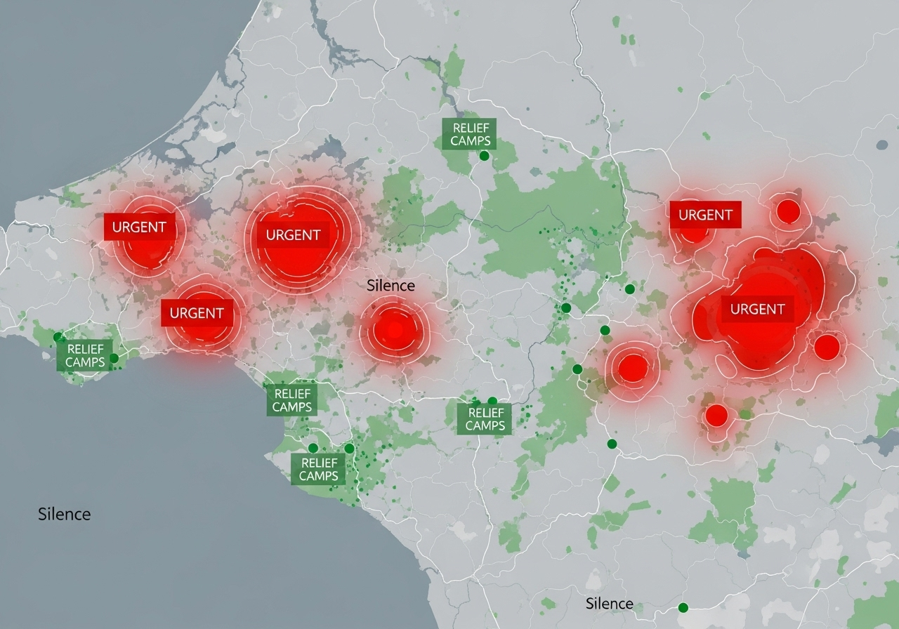 Fig 5. Mapping human stories: urgency and relief emerge as spatial patterns.
Why is this powerful? Because it shifts the perspective. Instead of endlessly scrolling through chaotic posts, responders can see where the most critical situations are unfolding. For social scientists, these maps reveal how communities respond during crises. For policymakers, they highlight gaps in communication and aid.
NLP gives us the words, but geography gives them context. Together, they let us map not just places, but people’s lived experiences.
Why This Matters
In disasters, every minute counts. NLP and geography together mean responders don’t just see numbers on a dashboard - they see human needs, mapped in real time.
This is not only about urgent issues but also helps to track public health outbreaks, migration, and community sentiment during social movements. Instead of relying on only text, we can draw a clear picture of how people are living, adapting, and interacting.
At its core, this is about turning voices into visibility.
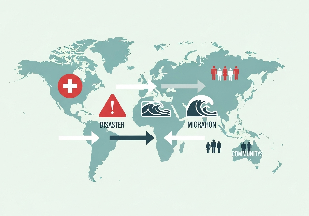 Fig 6. Beyond disasters: mapping human stories across society.
A teaser for the future
What we’ve seen here is just the beginning. Computer vision, combining NLP with satellite images, mobility data, and climate models, we can not only to map stories as they happen but also to predict what might come next.
GeoAI: where language, space, and data meet to tell the world’s stories in real time.
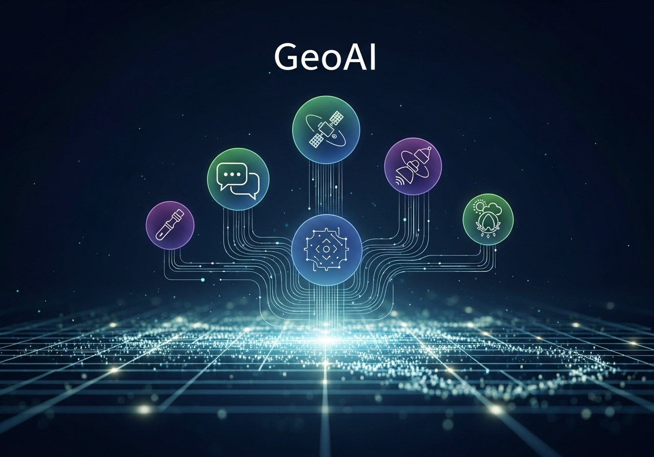 Fig 7. The concept of GeoAI
Conclusion
From scattered tweets to constructed insights, and from words to maps, we’ve seen how NLP and Geography can work together to capture the pulse of humanity. These tools don’t just process data - they give us new ways to listen, to see, and to respond when it matters most.
As technology advances, the potential of GeoAI will only grow, shaping how we understand not just places, but the people who live within them.
Author: Felix Do